Log in
All resources
Create a design
1,658 Free Images of World Map
bibliothèque nationale de france
beschreibung der städt der welt - braun & hogenberg - btv1b52512111k
latin-language maps
eran laor cartographic collection
national library of israel
jodocus hondius ii, nova totius terrarum orbis geographica ac hydrographica tabula, 1636
jodocus hondius ii
german renaissance
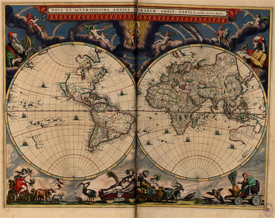
17th-century double hemisphere world maps
island of california on world maps
1942 maps of the world
atlantic charter
1830s maps of the world
maps by daniel lizars
a & c black general atlas of the world
1850s maps of the world
jodocus hondius ii, nova totius terrarum orbis geographica ac hydrographica tabula, 1636
eran laor cartographic collection
jodocus hondius ii, nova totius terrarum orbis geographica ac hydrographica tabula, 1636
eran laor cartographic collection
jodocus hondius ii, nova totius terrarum orbis geographica ac hydrographica tabula, 1636
eran laor cartographic collection
jodocus hondius ii, nova totius terrarum orbis geographica ac hydrographica tabula, 1636
eran laor cartographic collection
jodocus hondius ii, nova totius terrarum orbis geographica ac hydrographica tabula, 1636
eran laor cartographic collection
jodocus hondius ii, nova totius terrarum orbis geographica ac hydrographica tabula, 1636
eran laor cartographic collection
jodocus hondius ii, nova totius terrarum orbis geographica ac hydrographica tabula, 1636
eran laor cartographic collection
jodocus hondius ii, nova totius terrarum orbis geographica ac hydrographica tabula, 1636
eran laor cartographic collection
jodocus hondius ii, nova totius terrarum orbis geographica ac hydrographica tabula, 1636
eran laor cartographic collection
17th-century double hemisphere world maps
nuevo atlas o teatro mundo
maps by willem and johannes blaeu
1630s maps of the world
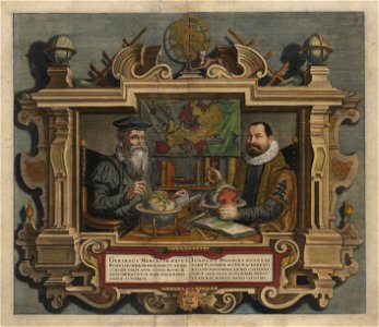
gerardus mercator
jodocus hondius
democritus by velazquez
baroque
wilhelm pleydenwurff
hartmann schedel
1600 world map by girolamo porro
1600s maps of the world
isaiah thomas (publisher)
1812 maps
eran laor cartographic collection
german renaissance,humanism
1470s maps of the world
latin-language maps
henricus hondius ii, nova totius terrarum orbis geographica ac hydrographica tabula, 1630
eran laor cartographic collection
armillary spheres in art
1770s maps of the world
cornell: persuasive cartography: the pj mode collection
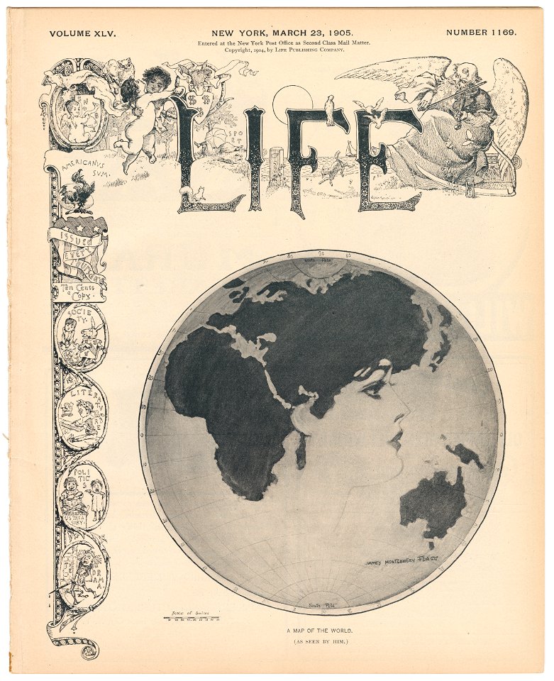
works by james montgomery flagg
latin-language maps
german renaissance
latin-language maps
german renaissance
19th-century double hemisphere world maps
1800s maps of the world
beschreibung der städt der welt - braun & hogenberg - btv1b52512111k
maps of kleve by braun & hogenberg
beschreibung der städt der welt - braun & hogenberg - btv1b52512111k
maps of hormuz by braun & hogenberg
beschreibung der städt der welt - braun & hogenberg - btv1b52512111k
maps of braunschweig by braun & hogenberg
beschreibung der städt der welt - braun & hogenberg - btv1b52512111k
maps of casablanca by braun & hogenberg
beschreibung der städt der welt - braun & hogenberg - btv1b52512111k
maps of neuss by braun & hogenberg
beschreibung der städt der welt - braun & hogenberg - btv1b52512111k
maps of valletta by braun & hogenberg
beschreibung der städt der welt - braun & hogenberg - btv1b52512111k
maps of parma by braun & hogenberg
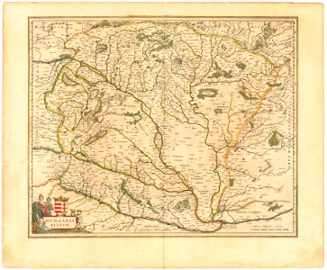
historical national coats of arms of hungary
1640s maps of hungary
island of california on world maps
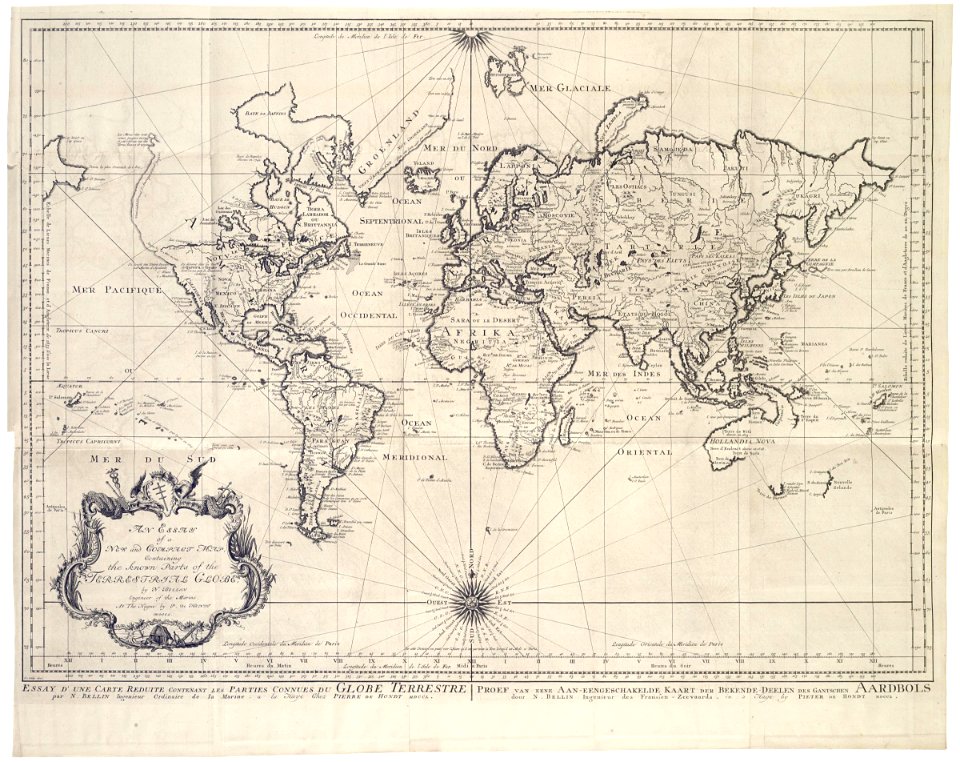
1700s maps of the world
maps by willem and johannes blaeu
1649 maps
beschreibung der städt der welt - braun & hogenberg - btv1b52512111k
maps of wissembourg by braun & hogenberg
beschreibung der städt der welt - braun & hogenberg - btv1b52512111k
maps of nuremberg by braun & hogenberg
beschreibung der städt der welt - braun & hogenberg - btv1b52512111k
maps of wittenberg by braun & hogenberg
1580s maps of the world
1598 maps
maps in the library of congress
1664 maps
old maps of the sea of japan
rangaku
1660s maps of the world
atlas maior
1630s maps of new york city
manatus map
old maps of the dutch east india company
1750 maps
1590s maps of the world
cornelis de jode
1770s maps of the world
maps by tomas lopez
1470s maps of the world
latin-language maps
1850s maps of the americas
maps by john tallis
svg maps of the world centered 10e
svg maps with robinson projection
17th-century double hemisphere world maps
1610s maps of the world
german renaissance,humanism
1490s maps of the world
cornell: persuasive cartography: the pj mode collection
james montgomery flagg's life covers
earth
maps
1470s maps of the world
latin-language maps
1780s maps of the world
german renaissance
1840s maps of the world
german renaissance
maps
flag
cornelius aurelius world map
1916 maps
book illustrations by robida
1879 illustrations
1740s maps of the world
maps by emanuel bowen
maps of eastern europe
french-language maps
1370s maps of egypt
catalan atlas
1470s maps of the world
latin-language maps
the geographical distribution of animals (book)
maps of ecozones
russian empire in thomas kitchen's general atlas (1773)
general atlas (1773)
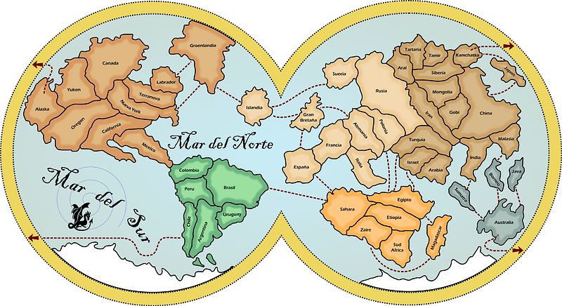
pictorial maps of the world
1876 maps of the world
1590s maps of the world
maps by girolamo porro
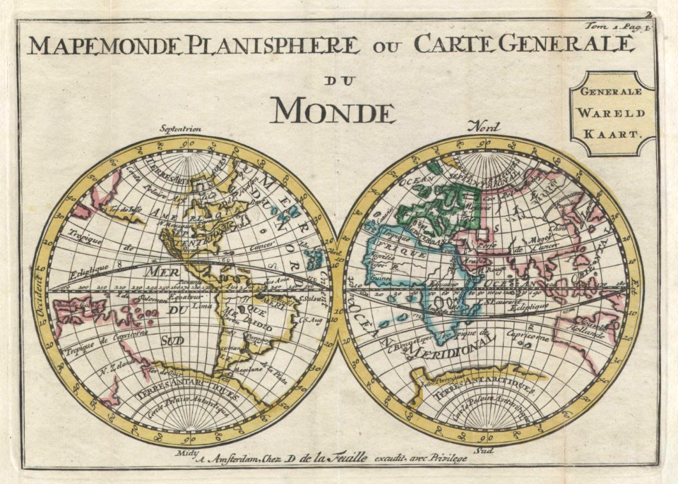
mappe-monde by guillaume delisle (18th century)
french-language maps of the world
jodocus hondius ii, nova totius terrarum orbis geographica ac hydrographica tabula, 1636
eran laor cartographic collection
1943 maps of the world
atlantic charter
reconstructions of old maps
german renaissance
reconstructions of old maps
german renaissance
maps by hendrik hondius the younger
1630s maps of the world
beschreibung der städt der welt - braun & hogenberg - btv1b52512111k
maps of groningen by braun & hogenberg
beschreibung der städt der welt - braun & hogenberg - btv1b52512111k
maps of mainz by braun & hogenberg
beschreibung der städt der welt - braun & hogenberg - btv1b52512111k
maps of heidelberg by braun & hogenberg
beschreibung der städt der welt - braun & hogenberg - btv1b52512111k
maps of dunkerque by braun & hogenberg
beschreibung der städt der welt - braun & hogenberg - btv1b52512111k
maps of nîmes by braun & hogenberg
tresor des cartes geographiques (1659)
1650s maps of the world
1790s maps of the world
rangaku
1645 maps of belgium
tournaisis
synopsis universae philologiae
maps of continents
beschreibung der städt der welt - braun & hogenberg - btv1b52512111k
maps of tunis by braun & hogenberg
beschreibung der städt der welt - braun & hogenberg - btv1b52512111k
maps of 's-hertogenbosch by braun & hogenberg
beschreibung der städt der welt - braun & hogenberg - btv1b52512111k
maps of münster (westfalen) by braun & hogenberg
beschreibung der städt der welt - braun & hogenberg - btv1b52512111k
panoramic maps of seville by braun & hogenberg
the worst journey in the world (1922, cherry-garrard)/volume 1
the worst journey in the world (1922, cherry-garrard)
french-language maps of the world
1700s maps of the world
16th-century double hemisphere world maps
1590s maps of the world
1570s maps of the world
typus orbis terrarum
1570s maps of the world
typus orbis terrarum
island of california on world maps
1680s maps of the world
beschreibung der städt der welt - braun & hogenberg - btv1b52512111k
maps of trier by braun & hogenberg
1840s maps of the world
german renaissance
latin-language maps
german renaissance
16th-century double hemisphere world maps
1590s maps of the world
beschreibung der städt der welt - braun & hogenberg - btv1b52512111k
dresden in the 1580s
henricus hondius ii, nova totius terrarum orbis geographica ac hydrographica tabula, 1630
eran laor cartographic collection
201 - 300 of 1,658
Next page
/ 17